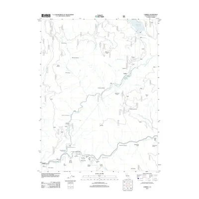
2012 Map of Caribou
USGS Topo · Published 2012About this map
Belden and Haven anchor the southwestern corner of this landscape, situated along the North Fork Feather River as it winds through a terrain of steep canyons and naming-rich gravel bars. The river serves as a primary corridor for transportation and infrastructure, as evidenced by the series of engineering works including Tunnel Twenty Three, Tunnel Twenty Four, and Tunnel Twenty Five. These features, alongside Belden Forebay and the settlement of Caribou, highlight the early 21st-century hydroelectric and rail presence in this part of Plumas County.
Find a feature on this map
61 named features on this map. Tap any name to fly to it.
Don’t see what you’re looking for? This feature index may not catch every label — zoom into the map to look around manually.
Map Details
Editions of this 2012 Caribou Map
This is the sole edition of this map. No revisions or reprints were ever made.
Other maps of this area

1886 · Lassen Peak
USGS Topo · 1:250,000

1888 · Bidwell Bar
USGS Topo · 1:125,000

1891 · Bidwell Bar
USGS Topo · 1:125,000

1892 · Lassen Peak
USGS Topo · 1:250,000

1893 · Bidwell Bar
USGS Topo · 1:125,000

1894 · Lassen Peak
USGS Topo · 1:250,000

1895 · Bidwell Bar
USGS Topo · 1:125,000

1897 · Bidwell Bar
USGS Topo · 1:125,000

1950 · Bucks Lake
USGS Topo · 1:62,500

1955 · Almanor
USGS Topo · 1:62,500