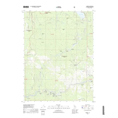
2018 Map of Caribou
USGS Topo · Published 2018About this map
Caribou sits at the heart of this Plumas County landscape where the North Fork Feather River and its East Branch meet. The terrain is defined by a series of riverside bars that speak to the region's hydraulic history, including Missouri Bar, Indian Bar, and the colorfully named Pea Soup Bar. These river-level flats are hemmed in by steep canyon walls and deep drainages like Deadwood Canyon and Serpentine Canyon.
Find a feature on this map
78 named features on this map. Tap any name to fly to it.
Don’t see what you’re looking for? This feature index may not catch every label — zoom into the map to look around manually.
Map Details
Editions of this 2018 Caribou Map
This is the sole edition of this map. No revisions or reprints were ever made.
Other maps of this area

1886 · Lassen Peak
USGS Topo · 1:250,000

1888 · Bidwell Bar
USGS Topo · 1:125,000

1891 · Bidwell Bar
USGS Topo · 1:125,000

1892 · Lassen Peak
USGS Topo · 1:250,000

1893 · Bidwell Bar
USGS Topo · 1:125,000

1894 · Lassen Peak
USGS Topo · 1:250,000

1895 · Bidwell Bar
USGS Topo · 1:125,000

1897 · Bidwell Bar
USGS Topo · 1:125,000

1950 · Bucks Lake
USGS Topo · 1:62,500

1955 · Almanor
USGS Topo · 1:62,500