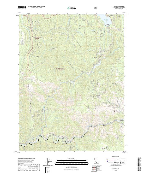
2022 Map of Caribou
USGS Topo · Published 2022About this map
Butt Valley Reservoir dominates the northeastern corner of this Plumas County terrain, marking a landscape defined by the deep canyons of the North Fork Feather River and the East Branch North Fork Feather River. The settlement of Caribou sits at the confluence of these high-relief drainages, serving as a focal point for the complex system of ravines and ridges that characterize this portion of the Plumas National Forest. Local history is deeply tied to the riverbanks, where numerous bars—named alluvial deposits often associated with early mining efforts—line the water, including Smiths Bar, Indian Bar, and the curiously named Pea Soup Bar. These river features, along with the Butt Lake Cem, offer specific points of interest for genealogists tracing family ties to the remote camps and settlements of the northern Sierra Nevada.
Find a feature on this map
62 named features on this map. Tap any name to fly to it.
Don’t see what you’re looking for? This feature index may not catch every label — zoom into the map to look around manually.
Map Details
Editions of this 2022 Caribou Map
This is the sole edition of this map. No revisions or reprints were ever made.
Other maps of this area

1886 · Lassen Peak
USGS Topo · 1:250,000

1888 · Bidwell Bar
USGS Topo · 1:125,000

1891 · Bidwell Bar
USGS Topo · 1:125,000

1892 · Lassen Peak
USGS Topo · 1:250,000

1893 · Bidwell Bar
USGS Topo · 1:125,000

1894 · Lassen Peak
USGS Topo · 1:250,000

1895 · Bidwell Bar
USGS Topo · 1:125,000

1897 · Bidwell Bar
USGS Topo · 1:125,000

1950 · Bucks Lake
USGS Topo · 1:62,500

1955 · Almanor
USGS Topo · 1:62,500