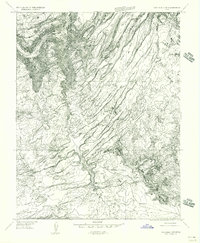
1955 Map of Carlisle 3 SW
USGS Topo · Published 1956About this map
Beef Basin and the surrounding high plateau of San Juan County are documented here in this 1955 survey, revealing a landscape defined by deep geologic fractures and ancient habitation. Several archaeological Ruins are identified near Ruin Park, marking a region where human history is etched into the desert floor alongside natural landmarks like Bobbys Hole and Calamity Mesa. The map captures the complex drainage systems of Cow Canyon and Cross Canyon as they cut toward the River Canyon at the Garfield County line. To the west, the broad expanses of Imperial Valley and Bull Valley contrast with the narrow, linear corridors of Devils Lane, while the seasonal waters of Red Lake and Upper Red Lake provide rare hydrologic points in this arid terrain.
Find a feature on this map
14 named features on this map. Tap any name to fly to it.
Don’t see what you’re looking for? This feature index may not catch every label — zoom into the map to look around manually.
Map Details
Editions of this 1955 Carlisle 3 SW Map
This is the sole edition of this map. No revisions or reprints were ever made.
Other maps of this area

1885 · San Rafael
USGS Topo · 1:250,000

1885 · La Sal
USGS Topo · 1:250,000

1886 · Henry Mountains
USGS Topo · 1:250,000

1886 · Abajo
USGS Topo · 1:250,000

1892 · Abajo
USGS Topo · 1:250,000

1892 · Henry Mountains
USGS Topo · 1:250,000

1893 · Abajo
USGS Topo · 1:250,000

1935 · Elk Ridge
USGS Topo · 1:96,000

1940 · Elk Ridge
USGS Topo · 1:125,000

1952 · Mouth of Dark Canyon
USGS Topo · 1:62,500