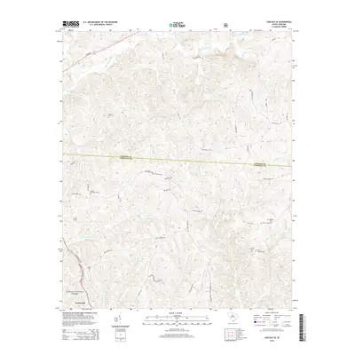
2014 Map of Carlisle SE
USGS Topo · Published 2014About this map
The Sumter National Forest defines the southwestern reaches of this Fairfield County landscape, where the settlement of Feasterville sits at a historic crossroads. This terrain is characterized by a dense network of watercourses, including the Little Sandy River and the W Fork Little River, which drain the ridges around Price Mountain. The map reveals a high concentration of family and community burial grounds, such as the Castles - Stevenson Cem, Dennis Crosby Cem, and Wiley Coleman Cem, offering significant value for genealogical research in this part of South Carolina. The rural road system, featuring routes like Old Cherokee Rd and Ashford Ferry Rd, connects these remote sites across the county line between Chester and Fairfield.
Find a feature on this map
47 named features on this map. Tap any name to fly to it.
Don’t see what you’re looking for? This feature index may not catch every label — zoom into the map to look around manually.
Map Details
Editions of this 2014 Carlisle SE Map
This is the sole edition of this map. No revisions or reprints were ever made.
Other maps of this area

1904 · Columbia
USGS Topo · 1:125,000

1941 · Spartanburg
USGS Topo · 1:250,000

1953 · Spartanburg
USGS Topo · 1:250,000

1960 · Spartanburg
USGS Topo · 1:250,000

1963 · Spartanburg
USGS Topo · 1:250,000

1964 · Spartanburg
USGS Topo · 1:250,000

1968 · Blackstock
USGS Topo · 1:24,000

1969 · Lebanon
USGS Topo · 1:24,000

1969 · Blair
USGS Topo · 1:24,000
1969 · Salem Crossroads
USGS Topo · 1:24,000