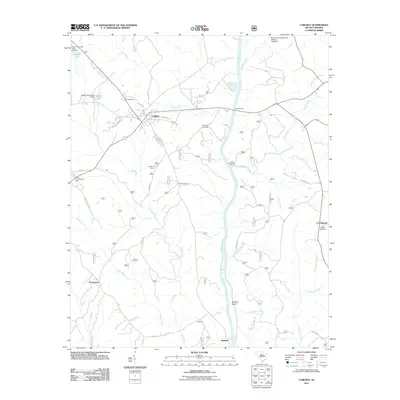
2011 Map of Carlisle
USGS Topo · Published 2011About this map
Carlisle serves as a central hub on this Union County landscape, where the confluence of regional roads meets the meandering Broad River. The area’s riverine history is evident at Fishdam Ford, a notable crossing point north of Shelton Island. The terrain is defined by a dense network of tributaries including Cane Creek, Brocks Creek, and Sandy River, which carve through the countryside toward the Broad River basin.
Find a feature on this map
46 named features on this map. Tap any name to fly to it.
Don’t see what you’re looking for? This feature index may not catch every label — zoom into the map to look around manually.
Map Details
Editions of this 2011 Carlisle Map
This is the sole edition of this map. No revisions or reprints were ever made.
Other maps of this area

1904 · Columbia
USGS Topo · 1:125,000

1941 · Spartanburg
USGS Topo · 1:250,000

1953 · Spartanburg
USGS Topo · 1:250,000

1960 · Spartanburg
USGS Topo · 1:250,000

1963 · Spartanburg
USGS Topo · 1:250,000

1964 · Spartanburg
USGS Topo · 1:250,000

1969 · Whitmire South
USGS Topo · 1:24,000

1969 · Blair
USGS Topo · 1:24,000
1969 · Salem Crossroads
USGS Topo · 1:24,000
1969 · Carlisle
USGS Topo · 1:24,000