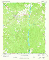
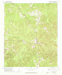
1969 Map of Carlisle
USGS Topo · Published 1973About this map
The town of Carlisle serves as a central hub where the Seaboard Coast Line and Southern railroads intersect, shaping the industrial and transport character of this Union County landscape. Much of the surrounding area is dedicated to the Sumter National Forest, creating a dense woodland environment punctuated by small family landmarks and rural institutions. The Broad River defines the eastern boundary, winding past Shelton Island and several creek confluences.
Find a feature on this map
28 named features on this map. Tap any name to fly to it.
Don’t see what you’re looking for? This feature index may not catch every label — zoom into the map to look around manually.
Map Details
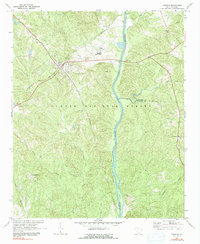
Editions of this 1969 Carlisle Map
2 editions found
Other maps of this area

1904 · Columbia
USGS Topo · 1:125,000

1941 · Spartanburg
USGS Topo · 1:250,000

1953 · Spartanburg
USGS Topo · 1:250,000

1960 · Spartanburg
USGS Topo · 1:250,000

1963 · Spartanburg
USGS Topo · 1:250,000

1964 · Spartanburg
USGS Topo · 1:250,000
1969 · Whitmire South
USGS Topo · 1:24,000
1969 · Blair
USGS Topo · 1:24,000
1969 · Salem Crossroads
USGS Topo · 1:24,000
1969 · Baton Rouge
USGS Topo · 1:24,000