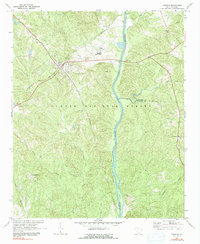
1969 Map of Carlisle
USGS Topo · Published 1991About this map
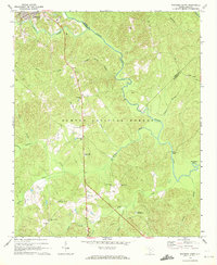
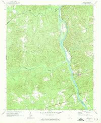
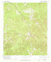
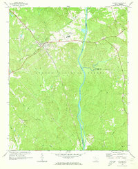
Carlisle serves as a central junction for the Southern and Seaboard Coast Line railroads, marking a significant transportation hub within the Sumter National Forest. This late-1960s landscape is defined by the Broad River and its numerous tributaries, including Cane Creek and Sandy River, which carve through the dense woodlands. The presence of several family and community burial sites, such as Hill Cem, Fish Dam Cem, and Kellys Cem, provides a detailed record of local genealogy and settlement patterns. Further south, the rural community of Tuckertown and St Lukes Ch illustrate the dispersed religious and social centers of the era. A Historical Monument stands near the river, signaling the area's deep-rooted heritage, while industrial markers like a Radio Tower and Sewage Disposal plant reflect the infrastructure of a growing Union County.
Find a feature on this map
30 named features on this map. Tap any name to fly to it.
Don’t see what you’re looking for? This feature index may not catch every label — zoom into the map to look around manually.
Map Details
Editions of this 1969 Carlisle Map
2 editions found
Other maps of this area

1904 · Columbia
USGS Topo · 1:125,000

1941 · Spartanburg
USGS Topo · 1:250,000

1953 · Spartanburg
USGS Topo · 1:250,000

1960 · Spartanburg
USGS Topo · 1:250,000

1963 · Spartanburg
USGS Topo · 1:250,000

1964 · Spartanburg
USGS Topo · 1:250,000
1969 · Whitmire South
USGS Topo · 1:24,000
1969 · Blair
USGS Topo · 1:24,000
1969 · Salem Crossroads
USGS Topo · 1:24,000
1969 · Carlisle
USGS Topo · 1:24,000