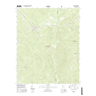
2017 Map of Carlisle
USGS Topo · Published 2017About this map
Carlisle serves as a central hub on this 2017 landscape, where the town layout is defined by the intersection of King Kennedy St and Janie Glymph Goree Blvd. To the south, the terrain becomes densely wooded as it enters the Sumter National Forest, a region defined by the meandering path of the Broad River and its numerous tributaries like Cane Cr and Coxs Cr.
Find a feature on this map
45 named features on this map. Tap any name to fly to it.
Don’t see what you’re looking for? This feature index may not catch every label — zoom into the map to look around manually.
Map Details
Editions of this 2017 Carlisle Map
This is the sole edition of this map. No revisions or reprints were ever made.
Other maps of this area

1904 · Columbia
USGS Topo · 1:125,000

1941 · Spartanburg
USGS Topo · 1:250,000

1953 · Spartanburg
USGS Topo · 1:250,000

1960 · Spartanburg
USGS Topo · 1:250,000

1963 · Spartanburg
USGS Topo · 1:250,000

1964 · Spartanburg
USGS Topo · 1:250,000

1969 · Whitmire South
USGS Topo · 1:24,000

1969 · Blair
USGS Topo · 1:24,000
1969 · Salem Crossroads
USGS Topo · 1:24,000
1969 · Carlisle
USGS Topo · 1:24,000