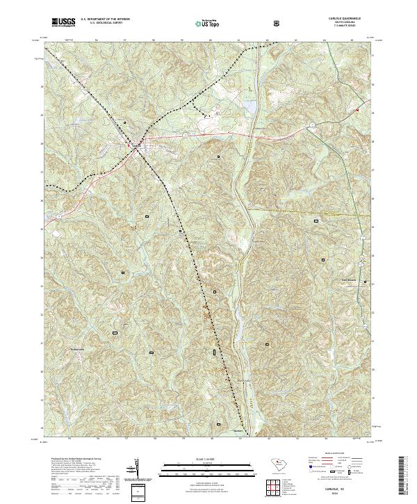
2024 Map of Carlisle
USGS Topo · Published 2024About this map
The Broad River serves as a central artery for this region, winding south past Shelton Island and the community of Herbert. This stretch of the river valley is deeply marked by early transit and settlement patterns, featuring the historical site of Smiths Ferry and several long-established burial grounds including Fish Dam Cem and the Cool Branch Church Graveyard. The town of Carlisle serves as a hub in the northwestern corner, where Janie Glymph Goree Blvd and King Kennedy St intersect, reflecting the local importance of street-level naming and genealogically significant sites like the nearby Hill Cem. Much of the central terrain is protected within the Sumter National Forest, preserving the wooded character of the drainages around Brocks Creek and Coxs Creek.
Find a feature on this map
62 named features on this map. Tap any name to fly to it.
Don’t see what you’re looking for? This feature index may not catch every label — zoom into the map to look around manually.
Map Details
Editions of this 2024 Carlisle Map
This is the sole edition of this map. No revisions or reprints were ever made.
Other maps of this area

1904 · Columbia
USGS Topo · 1:125,000

1941 · Spartanburg
USGS Topo · 1:250,000

1953 · Spartanburg
USGS Topo · 1:250,000

1960 · Spartanburg
USGS Topo · 1:250,000

1963 · Spartanburg
USGS Topo · 1:250,000

1964 · Spartanburg
USGS Topo · 1:250,000

1969 · Whitmire South
USGS Topo · 1:24,000

1969 · Blair
USGS Topo · 1:24,000
1969 · Salem Crossroads
USGS Topo · 1:24,000
1969 · Carlisle
USGS Topo · 1:24,000