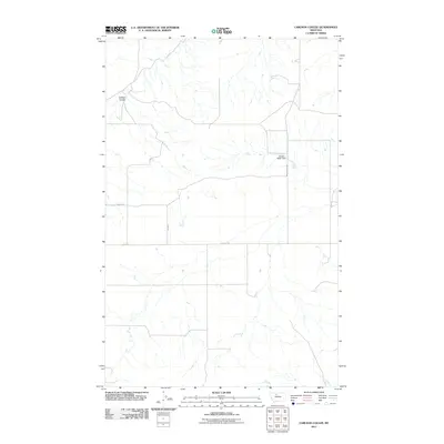
2011 Map of Carlson Coulee
USGS Topo · Published 2011About this map
Carlson Coulee carves through this northern Montana landscape, defining the drainage patterns of an area dominated by agricultural section lines and rural transit. The network of gravel and dirt roads, including Dugout Rd and Broadhurst Rd, suggests a territory organized for large-scale ranching and dryland farming during the early 21st century. A primary point of water management in this arid environment is the Purple Water Dam, which serves as a vital resource for local livestock or irrigation. The grid-like precision of 300 Rd E and 5700 Rd S reflects the systematic land divisions typical of Chouteau County, where the vastness of the terrain is navigated by these numbered and named thoroughfares.
Find a feature on this map
6 named features on this map. Tap any name to fly to it.
Don’t see what you’re looking for? This feature index may not catch every label — zoom into the map to look around manually.
Map Details
Editions of this 2011 Carlson Coulee Map
This is the sole edition of this map. No revisions or reprints were ever made.
Other maps of this area

1954 · Shelby
USGS Topo · 1:250,000

1958 · Shelby
USGS Topo · 1:250,000

1970 · Carlson Coulee
USGS Topo · 1:24,000

1970 · Knees NE
USGS Topo · 1:24,000

1970 · Uphill Creek
USGS Topo · 1:24,000

1970 · Knees
USGS Topo · 1:24,000

1970 · Pondera School
USGS Topo · 1:24,000
1970 · Russell Chapel
USGS Topo · 1:24,000
1970 · Mc Bridy Spring
USGS Topo · 1:24,000

1970 · Lothair SW
USGS Topo · 1:24,000