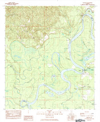
1984 Map of Carlton
USGS Topo · Published 1984About this map
The Alabama River winds through this 1984 survey, marking the complex borders of Clarke, Monroe, and Baldwin counties. Deeply significant to local history and genealogy, the map identifies the Grave of Red Eagle (Weatherford) near Brickyard, commemorating the Creek leader William Weatherford. The settlement of Carlton sits near the Stimpson State Game Sanctuary in the northwestern hills, while the riverbanks are dotted with historic river access points like Choctaw Bluff, Dixie Landing, and Davis Landing.
Find a feature on this map
45 named features on this map. Tap any name to fly to it.
Don’t see what you’re looking for? This feature index may not catch every label — zoom into the map to look around manually.
Map Details
Editions of this 1984 Carlton Map
This is the sole edition of this map. No revisions or reprints were ever made.
Other maps of this area

1942 · Perdido
USGS Topo · 1:62,500

1943 · Choctaw Bluff
USGS Topo · 1:62,500

1943 · Tensaw
USGS Topo · 1:62,500

1944 · Tensaw
USGS Topo · 1:62,500

1944 · Perdido
USGS Topo · 1:62,500

1946 · Choctaw Bluff
USGS Topo · 1:62,500

1953 · Andalusia
USGS Topo · 1:250,000

1957 · Andalusia
USGS Topo · 1:250,000

1972 · Chrysler
USGS Topo · 1:24,000

1972 · Gainestown
USGS Topo · 1:24,000