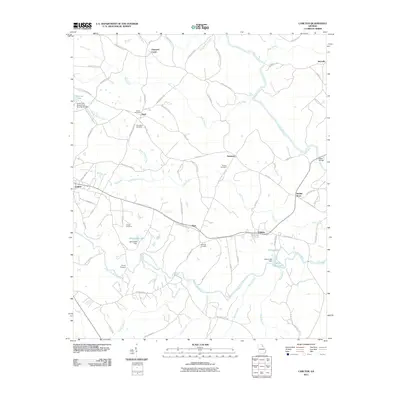
2011 Map of Carlton
USGS Topo · Published 2011About this map
Carlton and Comer anchor this pocket of Madison County, where the South Fork Broad River and its numerous tributaries like Holly Creek and Clouds Creek define the local topography. This 2011 survey illustrates a rural landscape where historic family and community landmarks persist alongside modern water management features like Whitehead Lake and Otter Run Lake. Small settlements such as Paoli and Nickville are linked by a network of named roads including Comer Paoli Rd and Old Fork Cemetery Rd, reflecting the long-established transit patterns of the region. Genealogists will find particular value in the documentation of numerous local burial sites, including the Old Fork Cemetery, David Cemetery, and Powers Cemetery, which are scattered throughout the agricultural lands between the river forks. The presence of Smiths Store and the Steel Bridge over the Broad River further emphasizes the enduring community nodes that have served this area for generations.
Find a feature on this map
83 named features on this map. Tap any name to fly to it.
Don’t see what you’re looking for? This feature index may not catch every label — zoom into the map to look around manually.
Map Details
Editions of this 2011 Carlton Map
This is the sole edition of this map. No revisions or reprints were ever made.
Other maps of this area

1891 · Carnesville
USGS Topo · 1:125,000

1893 · Elberton
USGS Topo · 1:125,000

1906 · Crawfordville
USGS Topo · 1:125,000

1953 · Athens
USGS Topo · 1:250,000

1954 · Greenville
USGS Topo · 1:250,000

1958 · Greenville
USGS Topo · 1:250,000

1958 · Athens
USGS Topo · 1:250,000

1958 · Danielsville
USGS Topo · 1:62,500

1958 · Elberton
USGS Topo · 1:62,500

1959 · Athens
USGS Topo · 1:250,000