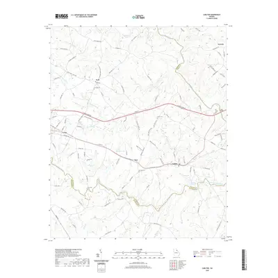
2020 Map of Carlton
USGS Topo · Published 2020About this map
The town of Comer and the community of Carlton anchor this 2020 record of the Georgia Piedmont, where the landscape is defined by the convergence of the Broad River and its major tributaries. The South Fork Broad River winds through the southern portion of the quadrangle, creating a rugged riparian network that includes Witcher Shoals and Cunningham Shoals. This modern topography documents the intersection of Madison, Elbert, and Oglethorpe Counties, tracing the enduring transport corridors of Railroad Ave and S Railroad Ave that historically shaped these settlements.
Find a feature on this map
114 named features on this map. Tap any name to fly to it.
Don’t see what you’re looking for? This feature index may not catch every label — zoom into the map to look around manually.
Map Details
Editions of this 2020 Carlton Map
This is the sole edition of this map. No revisions or reprints were ever made.
Other maps of this area

1891 · Carnesville
USGS Topo · 1:125,000

1893 · Elberton
USGS Topo · 1:125,000

1906 · Crawfordville
USGS Topo · 1:125,000

1953 · Athens
USGS Topo · 1:250,000

1954 · Greenville
USGS Topo · 1:250,000

1958 · Greenville
USGS Topo · 1:250,000

1958 · Athens
USGS Topo · 1:250,000

1958 · Danielsville
USGS Topo · 1:62,500

1958 · Elberton
USGS Topo · 1:62,500

1959 · Athens
USGS Topo · 1:250,000