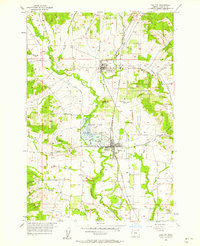
1957 Map of Carlton
USGS Topo · Published 1958About this map
The Southern Pacific railroad corridor anchors the agricultural development of the Tualatin Valley in this mid-century survey. The towns of Yamhill and Carlton serve as primary hubs, with the latter situated just south of the Carlton Lake State Game Refuge. This wetland area, including Carlton Lake, illustrates the historical drainage and water management patterns of the North Yamhill River watershed. The map records a landscape of small orchards and rural infrastructure, from the Hillside Sch in the west to the community-centered Cove Orchard in the north. Genealogists can locate several local burial grounds, including the McBride Cemetery and the Yamhill-Carlton Cemetery, which remain key markers of early family settlement in Yamhill County. The transition from the flat valley floor to the rising elevations of Alecs Butte highlights the topographical variety that influenced road placement and land use during this era of Oregon's history.
Find a feature on this map
24 named features on this map. Tap any name to fly to it.
Don’t see what you’re looking for? This feature index may not catch every label — zoom into the map to look around manually.
Map Details
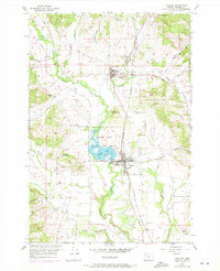
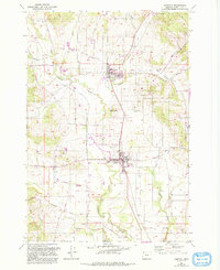
Editions of this 1957 Carlton Map
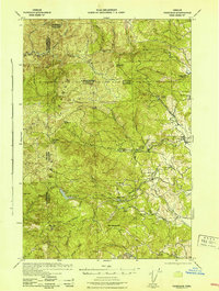
Other maps of this area

1924 · Mc Minnville
USGS Topo · 1:48,000

1926 · Mc Minnville
USGS Topo · 1:62,500

1940 · McMinnville
USGS Topo · 1:62,500

1941 · Yamhill
USGS Topo · 1:62,500

1942 · Sheridan
USGS Topo · 1:62,500

1942 · Yamhill
USGS Topo · 1:62,500
1942 · Fairdale
USGS Topo · 1:62,500

1948 · Vancouver
USGS Topo · 1:250,000

1950 · Vancouver
USGS Topo · 1:250,000

1950 · Vancouver
USGS Topo · 1:250,000