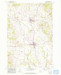
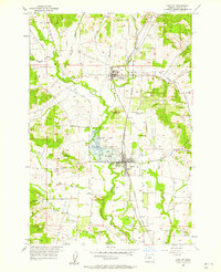
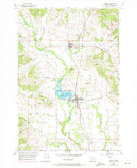
1957 Map of Carlton
USGS Topo · Published 1993About this map
The Yamhill River and its North Fork wind through this Willamette Valley agricultural landscape, anchoring the historic communities of Yamhill and Carlton. The area's development is closely tied to the Southern Pacific railroad line, which bisects the towns and parallels the river drainage. To the south of Yamhill, the Carlton Lake State Wildlife Refuge occupies a significant basin, while prominent elevations like Alecs Butte break the valley floor. Rural life is evidenced by a network of family-named routes such as Pike Road, Sitton Road, and Bishop Scott Road. Local heritage is preserved at sites like the Yamhill-Carlton Cemetery and McBride Cemetery, which serve as vital touchpoints for genealogical research. The map also captures civic landmarks including the Yamhill High Sch, Beulah Park, and the recreation area at Lower Wennerberg Park.
Find a feature on this map
36 named features on this map. Tap any name to fly to it.
Don’t see what you’re looking for? This feature index may not catch every label — zoom into the map to look around manually.
Map Details
Editions of this 1957 Carlton Map
Other maps of this area

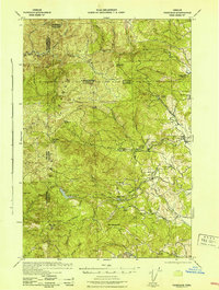
1924 · Mc Minnville
USGS Topo · 1:48,000

1926 · Mc Minnville
USGS Topo · 1:62,500

1940 · McMinnville
USGS Topo · 1:62,500

1941 · Yamhill
USGS Topo · 1:62,500

1942 · Sheridan
USGS Topo · 1:62,500

1942 · Yamhill
USGS Topo · 1:62,500
1942 · Fairdale
USGS Topo · 1:62,500

1948 · Vancouver
USGS Topo · 1:250,000

1950 · Vancouver
USGS Topo · 1:250,000

1950 · Vancouver
USGS Topo · 1:250,000