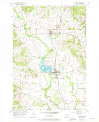
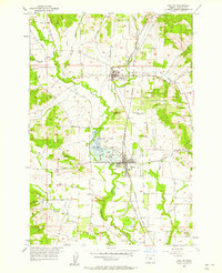
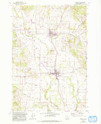
1957 Map of Carlton
USGS Topo · Published 1971About this map
The North Yamhill River and Yamhill River wind through this agricultural landscape, anchoring the settlements of Carlton and Yamhill. The 1957 survey, with revisions from 1970, reveals a region defined by its rail-and-water geography, where the Southern Pacific railroad runs parallel to the valley's primary drainage. Central to the map is the Carlton Lake State Game Refuge, surrounding the waters of Carlton Lake, a notable local landmark for wildlife and conservation.
Find a feature on this map
26 named features on this map. Tap any name to fly to it.
Don’t see what you’re looking for? This feature index may not catch every label — zoom into the map to look around manually.
Map Details
Editions of this 1957 Carlton Map
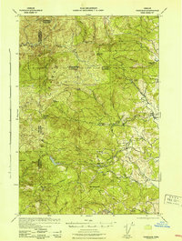
Other maps of this area

1924 · Mc Minnville
USGS Topo · 1:48,000

1926 · Mc Minnville
USGS Topo · 1:62,500

1940 · McMinnville
USGS Topo · 1:62,500

1941 · Yamhill
USGS Topo · 1:62,500

1942 · Sheridan
USGS Topo · 1:62,500

1942 · Yamhill
USGS Topo · 1:62,500
1942 · Fairdale
USGS Topo · 1:62,500

1948 · Vancouver
USGS Topo · 1:250,000

1950 · Vancouver
USGS Topo · 1:250,000

1950 · Vancouver
USGS Topo · 1:250,000