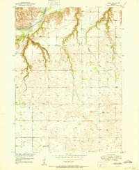
1950 Map of Carns
USGS Topo · Published 1950About this map
The Niorrara River flows through the northern reaches of this landscape, marking the boundary between Keya Paha and Rock counties. In the mid-century, this rural expanse was defined by a network of small school districts, each centered on a local schoolhouse such as Rock Creek Sch, Mariaville Sch, and Dugger Sch. The settlement of Carns sits near the river, serving as a focal point for the surrounding Simpson and Long Pine townships.
Find a feature on this map
22 named features on this map. Tap any name to fly to it.
Don’t see what you’re looking for? This feature index may not catch every label — zoom into the map to look around manually.
Map Details
Editions of this 1950 Carns Map
2 editions found
Other maps of this area

1949 · Jamison SW
USGS Topo · 1:24,000

1949 · Riverview
USGS Topo · 1:24,000

1949 · Carns
USGS Topo · 1:24,000

1950 · Carns
USGS Topo · 1:24,000

1950 · Riverview
USGS Topo · 1:24,000

1950 · Mariaville
USGS Topo · 1:24,000

1951 · Jamison SW
USGS Topo · 1:24,000

1954 · Newport NE
USGS Topo · 1:24,000

1954 · Bassett
USGS Topo · 1:24,000

1954 · Newport
USGS Topo · 1:24,000