1950 Map of Carolina SE
USGS Topo · Published 1950About this map
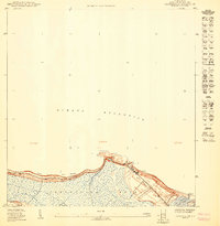
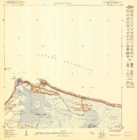
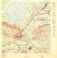
Central Canóvanas stands as the industrial anchor of this mid-century landscape, situated along a prominent bend of the Río Grande de Loíza. The map reveals an intricate network of water management and transport essential to the local sugar economy, with numerous drainage features like Caño San Isidro and Caño Norberto cutting through the lowlands. The industrial presence is further marked by the Fajardo Development Co RR, which links the various agricultural colonies across the terrain.
Find a feature on this map
34 named features on this map. Tap any name to fly to it.
Don’t see what you’re looking for? This feature index may not catch every label — zoom into the map to look around manually.
Map Details
Editions of this 1950 Carolina SE Map
This is the sole edition of this map. No revisions or reprints were ever made.
Historical Maps of Canóvanas Through Time
3 maps found