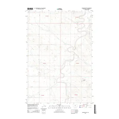
2015 Map of Caroline Butte
USGS Topo · Published 2015About this map
The Little Missouri River carves a winding, serpentine path through the heart of this Harding County landscape, creating a complex network of drainages and seasonal creek beds. The terrain is defined by its subtle elevation changes and the prominent landmark of Caroline Butte in the eastern section. This area is crisscrossed by numerous waterways, including Wagon Cr, Ebert Cr, and Plum Cr, which feed into the river's basin.
Find a feature on this map
19 named features on this map. Tap any name to fly to it.
Don’t see what you’re looking for? This feature index may not catch every label — zoom into the map to look around manually.
Map Details
Editions of this 2015 Caroline Butte Map
This is the sole edition of this map. No revisions or reprints were ever made.
Other maps of this area

1935 · Buffalo
USGS Topo · 1:125,000

1954 · Lemmon
USGS Topo · 1:250,000

1954 · Ekalaka
USGS Topo · 1:250,000

1956 · Ekalaka
USGS Topo · 1:250,000

1957 · Lemmon
USGS Topo · 1:250,000

1958 · Ekalaka
USGS Topo · 1:250,000

1965 · Ekalaka
USGS Topo · 1:250,000

1973 · Gallup Creek
USGS Topo · 1:24,000

1974 · Caroline Butte
USGS Topo · 1:24,000

1974 · Pine Spring
USGS Topo · 1:24,000