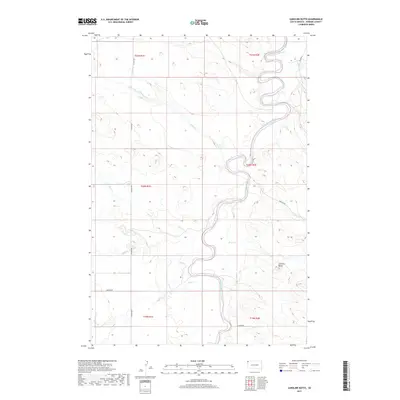
2017 Map of Caroline Butte
USGS Topo · Published 2017About this map
The Little Missouri River snakes through the high plains of Harding County in this 2017 topographic record, defining a landscape of complex drainage basins and isolated landmarks. The namesake Caroline Butte stands as a prominent elevation in the eastern half of the map, overlooking a network of seasonal waterways including Oley Cr, Smiley Cr, and Plum Cr. The terrain is characterized by its creek systems, such as Wagon Cr in the north and the branching N Slick Cr and Slick Cr to the south. Human presence is marked by a grid of rural roads and section boundaries, including Co HWY 867 and Lewton RD, which navigate the draws and rises of the river valley. This map provides a modern look at the land's hydrology and topography, capturing the quiet isolation of the South Dakota prairie.
Find a feature on this map
20 named features on this map. Tap any name to fly to it.
Don’t see what you’re looking for? This feature index may not catch every label — zoom into the map to look around manually.
Map Details
Editions of this 2017 Caroline Butte Map
This is the sole edition of this map. No revisions or reprints were ever made.
Other maps of this area

1935 · Buffalo
USGS Topo · 1:125,000

1954 · Lemmon
USGS Topo · 1:250,000

1954 · Ekalaka
USGS Topo · 1:250,000

1956 · Ekalaka
USGS Topo · 1:250,000

1957 · Lemmon
USGS Topo · 1:250,000

1958 · Ekalaka
USGS Topo · 1:250,000

1965 · Ekalaka
USGS Topo · 1:250,000

1973 · Gallup Creek
USGS Topo · 1:24,000

1974 · Caroline Butte
USGS Topo · 1:24,000

1974 · Pine Spring
USGS Topo · 1:24,000