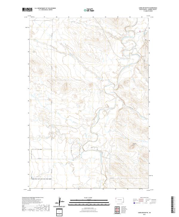
2021 Map of Caroline Butte
USGS Topo · Published 2021About this map
Little Missouri River meanders through this section of Harding County, shaping a drainage basin defined by seasonal creeks and rising buttes. The namesake Caroline Butte stands as a prominent landmark in the southeast, overlooking a landscape where local routes like River Rd and Bullock Rd trace the paths of least resistance through the breaks. The intricate network of waterways, including Wagon Cr, Ebert Cr, and Slick Cr, illustrates the hydrological pattern of the high plains, where these ephemeral streams feed into the larger river system. While primarily open range, the inclusion of Co Hwy 867 and Latham Rd indicates the vital modern corridor for ranching and land management in this sparsely populated region of South Dakota.
Find a feature on this map
19 named features on this map. Tap any name to fly to it.
Don’t see what you’re looking for? This feature index may not catch every label — zoom into the map to look around manually.
Map Details
Editions of this 2021 Caroline Butte Map
This is the sole edition of this map. No revisions or reprints were ever made.
Other maps of this area

1935 · Buffalo
USGS Topo · 1:125,000

1954 · Lemmon
USGS Topo · 1:250,000

1954 · Ekalaka
USGS Topo · 1:250,000

1956 · Ekalaka
USGS Topo · 1:250,000

1957 · Lemmon
USGS Topo · 1:250,000

1958 · Ekalaka
USGS Topo · 1:250,000

1965 · Ekalaka
USGS Topo · 1:250,000

1973 · Gallup Creek
USGS Topo · 1:24,000

1974 · Caroline Butte
USGS Topo · 1:24,000

1974 · Pine Spring
USGS Topo · 1:24,000