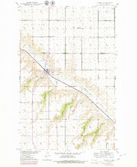
1949 Map of Carpio
USGS Topo · Published 1980About this map
The Des Lacs River valley cuts a deep course through the northern plains of Ward County, serving as the primary corridor for both the Soo Line railroad and Highway 52. At the center of this drainage network lies Carpio, a settlement positioned at the confluence of several prominent draws including Flaten Coulee and Johnson Coulee. The map reveals a rural landscape defined by township sections and communal focal points, such as Nazareth Ch and local education centers like Helseth Sch and Skarsbo Sch.
Find a feature on this map
21 named features on this map. Tap any name to fly to it.
Don’t see what you’re looking for? This feature index may not catch every label — zoom into the map to look around manually.
Map Details
Editions of this 1949 Carpio Map
4 editions found
Other maps of this area

1947 · Tolley
USGS Topo · 1:62,500

1949 · Tolley SE
USGS Topo · 1:24,000

1949 · Hartland
USGS Topo · 1:24,000

1949 · Carpio NE
USGS Topo · 1:24,000

1949 · Carpio
USGS Topo · 1:24,000

1949 · Grano SW
USGS Topo · 1:24,000

1949 · Grano
USGS Topo · 1:24,000

1950 · Tolley
USGS Topo · 1:62,500

1950 · Des Lacs
USGS Topo · 1:24,000
1951 · Grano
USGS Topo · 1:62,500