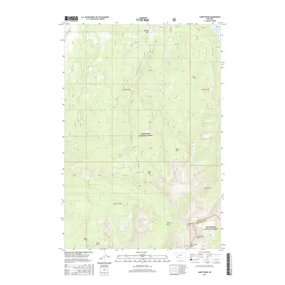
2017 Map of Carpp Ridge
USGS Topo · Published 2017About this map
The high-elevation terrain of the Anaconda Range dominates this landscape along the border of Deerlodge National Forest and Beaverhead National Forest. Following the spine of the Continental Divide at the southern edge of the map, the topography drops steeply into a series of glacial basins and ridges. Water flows through a network of alpine sources, including Carpp Lake and Lower Carpp Lake, which feed into Carpp Cr as it winds north of Carpp Ridge. The rugged character of the area is further defined by isolated bodies of water like George Lake, Spruce Lake, and Sauer Lake. To the north, the terrain transitions toward McDougal Gulch and Dry Gulch, while the east is marked by the E Fork Reservoir. This 2017 survey captures a preserved wilderness environment where natural landmarks like Beaverhead Mtn and Porter Ridge serve as primary points of orientation.
Find a feature on this map
32 named features on this map. Tap any name to fly to it.
Don’t see what you’re looking for? This feature index may not catch every label — zoom into the map to look around manually.
Map Details
Editions of this 2017 Carpp Ridge Map
This is the sole edition of this map. No revisions or reprints were ever made.
Other maps of this area

1908 · Philipsburg
USGS Topo · 1:125,000

1909 · Sapphire
USGS Topo · 1:125,000

1947 · Butte
USGS Topo · 1:250,000

1955 · Dillon
USGS Topo · 1:250,000

1957 · Dillon
USGS Topo · 1:250,000

1958 · Butte
USGS Topo · 1:250,000

1958 · Dillon
USGS Topo · 1:250,000

1960 · Butte
USGS Topo · 1:250,000

1962 · Butte
USGS Topo · 1:250,000

1962 · Dillon
USGS Topo · 1:250,000