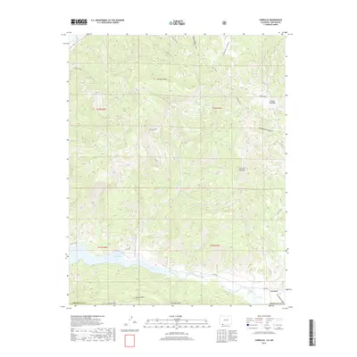
2019 Map of Carracas
USGS Topo · Published 2019About this map
Navajo Reservoir and the San Juan River corridor dominate the southern landscape of this 2019 Archuleta County survey, marking a significant hydrologic and recreational focal point on the Colorado border. The settlement of Carracas sits near the river's path, tucked beneath the prominent elevation of the Carracas Rim and the extensive Carracas Mesa. This area reflects a rugged geography of high plateaus and deep drainage systems, including Sandoval Canyon and Cabezon Canyon, which cut through the mesas. A network of historical and modern routes, such as Indian Rte 175 and Co Rd 500, provides access through the terrain. To the north, the high ground of Sandoval Mesa and the distinct peak of Cerro del Zopilote overlook a complex system of dry washes and seasonal watercourses like Round Meadow Cr and Arroyo Escondido.
Find a feature on this map
29 named features on this map. Tap any name to fly to it.
Don’t see what you’re looking for? This feature index may not catch every label — zoom into the map to look around manually.
Map Details
Editions of this 2019 Carracas Map
This is the sole edition of this map. No revisions or reprints were ever made.
Other maps of this area

1889 · Largo
USGS Topo · 1:250,000

1895 · Largo
USGS Topo · 1:250,000

1924 · Pagosa Springs
USGS Topo · 1:125,000

1927 · Pagosa Springs
USGS Topo · 1:125,000

1945 · Durango
USGS Topo · 1:250,000

1953 · Durango
USGS Topo · 1:250,000

1954 · Durango
USGS Topo · 1:250,000

1954 · Allison
USGS Topo · 1:24,000

1954 · Carracas
USGS Topo · 1:24,000

1954 · Rosa
USGS Topo · 1:24,000