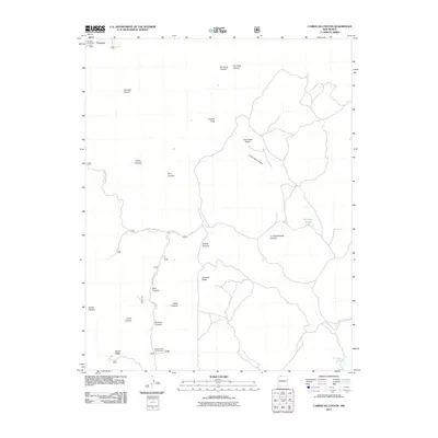
2011 Map of Carracas Canyon
USGS Topo · Published 2011About this map
Carracas sits at the northern edge of this high-desert landscape in Rio Arriba County, where the Carracas Cemetery serves as a primary point of interest for those researching local family history. The topography is defined by the massive Carracas Mesa and the prominent Frijoles Peak, which rise above a complex network of drainages including Tee Quee Canyon, Los Cuates Canyon, and La Chamisalosa Canyon. In the southern reaches, the Buzzard Park Campground indicates the area's modern recreational use, while Santiago Pond and Ed Ladd Lake provide essential water sources in an otherwise arid environment. Navigation across this varied terrain relies on established routes such as Carracas Mesa Rd and Forest Rd 312, which connect the isolated canyons and ridges characteristic of this corner of New Mexico.
Find a feature on this map
26 named features on this map. Tap any name to fly to it.
Don’t see what you’re looking for? This feature index may not catch every label — zoom into the map to look around manually.
Map Details
Editions of this 2011 Carracas Canyon Map
This is the sole edition of this map. No revisions or reprints were ever made.
Other maps of this area

1889 · Largo
USGS Topo · 1:250,000

1895 · Largo
USGS Topo · 1:250,000

1924 · Pagosa Springs
USGS Topo · 1:125,000

1927 · Pagosa Springs
USGS Topo · 1:125,000

1945 · Durango
USGS Topo · 1:250,000

1953 · Durango
USGS Topo · 1:250,000

1954 · Durango
USGS Topo · 1:250,000

1954 · Carracas
USGS Topo · 1:24,000

1954 · Aztec
USGS Topo · 1:250,000

1957 · Pagosa Junction
USGS Topo · 1:62,500