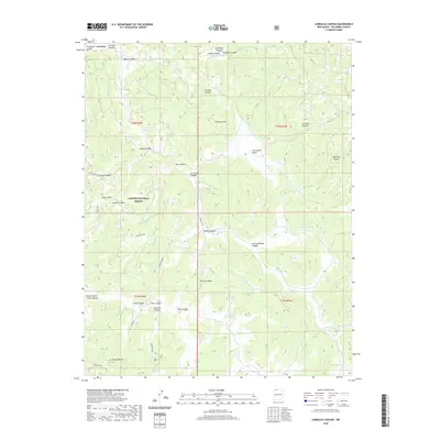
2020 Map of Carracas Canyon
USGS Topo · Published 2020About this map
Carson National Forest defines the rugged character of this Rio Arriba County landscape, where the high country is marked by the prominent Frijoles Peak and the expansive plateaus of Carracas Mesa and American Mesa. This modern topographic survey illustrates a complex network of drainage systems, including Salada Canyon and Carracas Canyon, which cut deeply through the terrain. The presence of vital water sources like Boiler Spring, Vallo Spring, and Willow Spring points to the essential locations for livestock and wildlife in this arid environment. The map also traces Forest Rd 312 as it winds through the canyons, providing a window into the modern management of these public lands. Small water bodies such as Ed Ladd Lake and Santiago Pond serve as rare catchments within the basin-and-ridge topography.
Find a feature on this map
42 named features on this map. Tap any name to fly to it.
Don’t see what you’re looking for? This feature index may not catch every label — zoom into the map to look around manually.
Map Details
Editions of this 2020 Carracas Canyon Map
This is the sole edition of this map. No revisions or reprints were ever made.
Other maps of this area

1889 · Largo
USGS Topo · 1:250,000

1895 · Largo
USGS Topo · 1:250,000

1924 · Pagosa Springs
USGS Topo · 1:125,000

1927 · Pagosa Springs
USGS Topo · 1:125,000

1945 · Durango
USGS Topo · 1:250,000

1953 · Durango
USGS Topo · 1:250,000

1954 · Durango
USGS Topo · 1:250,000

1954 · Carracas
USGS Topo · 1:24,000

1954 · Aztec
USGS Topo · 1:250,000

1957 · Pagosa Junction
USGS Topo · 1:62,500