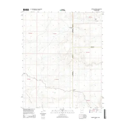
2014 Map of Carrisito Spring
USGS Topo · Published 2014About this map
Carrisito Spring serves as a vital water point in this high-desert borderland where Apache County meets the New Mexico state line. The landscape is defined by the significant drainage of Carrizo Wash, which meanders across the southern sections of the quadrangle, carving a path through the arid terrain. To the north, the topography is increasingly complex, marked by deep incisions like Blanco Canyon and Little Blanco Canyon, alongside the appropriately named Horse Canyon. This 2014 survey documents a sparsely settled region primarily accessed by utility and forest routes such as CO Road 6002 and NF-19. The map provides a precise view of the intersection of three counties—Apache, Cibola, and Catron—illustrating how legal and political boundaries overlay the natural features of Twentytwo Draw.
Find a feature on this map
19 named features on this map. Tap any name to fly to it.
Don’t see what you’re looking for? This feature index may not catch every label — zoom into the map to look around manually.
Map Details
Editions of this 2014 Carrisito Spring Map
This is the sole edition of this map. No revisions or reprints were ever made.
Other maps of this area

1886 · St Johns
USGS Topo · 1:250,000

1892 · St Johns
USGS Topo · 1:250,000

1954 · Saint Johns
USGS Topo · 1:250,000

1957 · Saint Johns
USGS Topo · 1:250,000

1958 · Saint Johns
USGS Topo · 1:250,000

1962 · Saint Johns
USGS Topo · 1:250,000

1971 · Mesa Parada NW
USGS Topo · 1:24,000

1971 · Mesa Parada
USGS Topo · 1:24,000

1972 · Twentytwo Spring
USGS Topo · 1:24,000

1972 · Cantaralo Spring
USGS Topo · 1:24,000