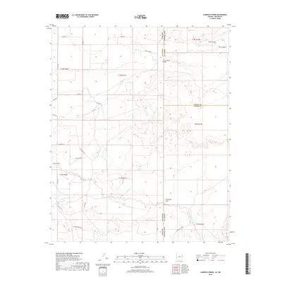
2018 Map of Carrisito Spring
USGS Topo · Published 2018About this map
Carrisito Spring serves as a vital water source in this high-desert landscape where the borders of Arizona and New Mexico meet. The map reveals a transition from the plateaus of Apache County into the canyons of Cibola and Catron Counties. Major drainage systems like Carrizo Wash and Buffalo Creek define the hydrology of the region, carving through the terrain near Blanco Canyon and Little Blanco Canyon. The area is marked by a network of modern rural roads and ranch tracks, such as Chappell Hill and Old Meadow Ln, which provide access to the remote sections of the high country. This modern survey demonstrates the persistence of traditional land divisions, showing the precise intersection of three counties—Apache, Cibola, and Catron—along the state line. The presence of features like Twentytwo Draw and Horse Canyon underscores the complex topography that has historically challenged movement across this borderland.
Find a feature on this map
33 named features on this map. Tap any name to fly to it.
Don’t see what you’re looking for? This feature index may not catch every label — zoom into the map to look around manually.
Map Details
Editions of this 2018 Carrisito Spring Map
This is the sole edition of this map. No revisions or reprints were ever made.
Other maps of this area

1886 · St Johns
USGS Topo · 1:250,000

1892 · St Johns
USGS Topo · 1:250,000

1954 · Saint Johns
USGS Topo · 1:250,000

1957 · Saint Johns
USGS Topo · 1:250,000

1958 · Saint Johns
USGS Topo · 1:250,000

1962 · Saint Johns
USGS Topo · 1:250,000

1971 · Mesa Parada NW
USGS Topo · 1:24,000

1971 · Mesa Parada
USGS Topo · 1:24,000

1972 · Twentytwo Spring
USGS Topo · 1:24,000

1972 · Cantaralo Spring
USGS Topo · 1:24,000