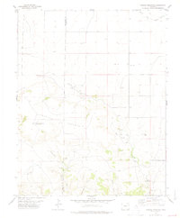
1978 Map of Carrizo Mountain
USGS Topo · Published 1979About this map
Carrizo Mountain dominates this high plains landscape on the border of Baca and Las Animas counties, where water remains the defining element of settlement and survival. In the late 1970s, the terrain was characterized by a network of seasonal drainages and essential water sources, including the central Carrizo Creek and its tributary, East Carrizo Creek. These lifelines supported localized ranching operations like the Everett Ranch, while Carrizo Springs provided a focal point for activity in an otherwise sparsely populated region.
Find a feature on this map
21 named features on this map. Tap any name to fly to it.
Don’t see what you’re looking for? This feature index may not catch every label — zoom into the map to look around manually.
Map Details
Editions of this 1978 Carrizo Mountain Map
This is the sole edition of this map. No revisions or reprints were ever made.
Other maps of this area

1891 · Springfield
USGS Topo · 1:125,000

1892 · Mt Carrizo
USGS Topo · 1:125,000

1893 · Springfield
USGS Topo · 1:125,000

1955 · La Junta
USGS Topo · 1:250,000

1958 · La Junta
USGS Topo · 1:250,000

1968 · La Junta
USGS Topo · 1:250,000
1978 · Furnish Canyon East
USGS Topo · 1:24,000

1978 · Pintada Creek
USGS Topo · 1:24,000

1978 · Utleyville
USGS Topo · 1:24,000
1978 · Furnish Canyon West
USGS Topo · 1:24,000