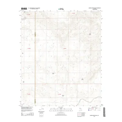
2015 Map of Carrizo Mountain NE
USGS Topo · Published 2015About this map
The Fish Creek Mountains dominate the northeastern portion of this arid landscape, characterized by complex drainage systems and desert plateaus. The topography is defined by significant landmarks such as Split Mtn and the deep incisions of Barrett Canyon and Deguynos Canyon. Hydrological patterns are marked by ephemeral flows through Fish Creek Wash, Gert Wash, and the prominent Carrizo Wash near the southern boundary. This 2015 survey illustrates the remote character of the region along the border of San Diego Co and Imperial Co. A distinct historic transportation trace, the Gr S Overland, crosses the southwestern corner, hinting at the path of early travel through the Colorado Desert. Settlement remains absent, with the terrain divided between high plateaus like East Mesa and South Mesa and the winding corridor of Red Rock Canyon.
Find a feature on this map
19 named features on this map. Tap any name to fly to it.
Don’t see what you’re looking for? This feature index may not catch every label — zoom into the map to look around manually.
Map Details
Editions of this 2015 Carrizo Mountain NE Map
This is the sole edition of this map. No revisions or reprints were ever made.
Other maps of this area

1915 · El Centro
USGS Topo · 1:125,000

1931 · Vallecito
USGS Topo · 1:125,000

1931 · Carrizo
USGS Topo · 1:125,000

1940 · Kane Spring
USGS Topo · 1:62,500

1940 · Plaster City
USGS Topo · 1:62,500

1942 · Barrel Spring
USGS Topo · 1:62,500

1942 · El Centro
USGS Topo · 1:250,000

1942 · Carrizo Mtn
USGS Topo · 1:62,500

1943 · Vallecito
USGS Topo · 1:125,000

1944 · Plaster City
USGS Topo · 1:62,500