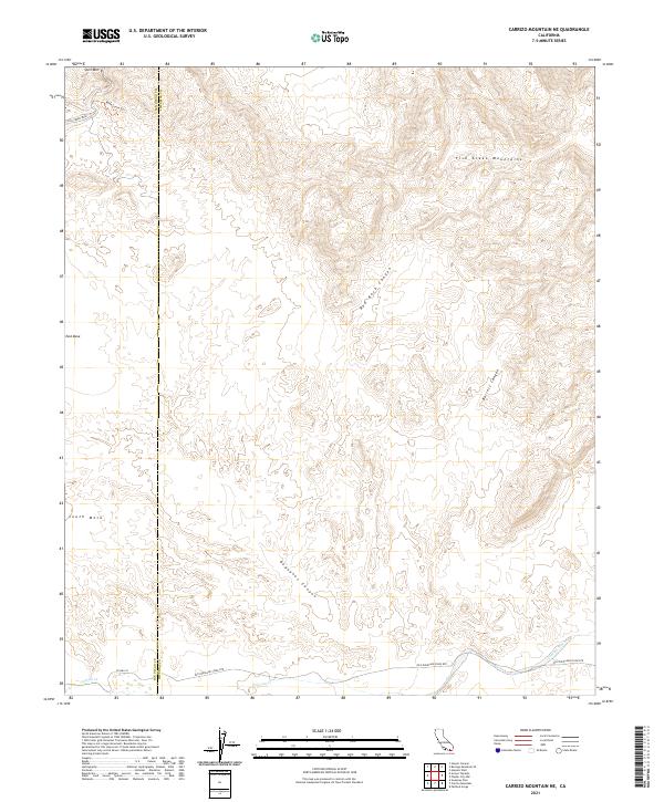
2021 Map of Carrizo Mountain NE
USGS Topo · Published 2021About this map
The Old Overland Stage Rte traces a historical transport corridor across the southern portion of this landscape, marking the intersection of the San Diego Co and Imperial Co boundary. This desert terrain is defined by complex erosional features, including the notable Wind Caves Trl near Split Mtn and the steep descents of Deguynos Canyon. The geography reflects the arid transition from the elevated East Mesa and South Mesa into the deep drainage systems of Fish Creek Wash and the Carrizo Wash. The map documents a rugged environment where early western transit routes were forced to navigate between the Fish Creek Mountains and prominent geological breaks like Red Rock Canyon, providing a detailed look at the physical constraints faced by travelers on the historic stage line.
Find a feature on this map
20 named features on this map. Tap any name to fly to it.
Don’t see what you’re looking for? This feature index may not catch every label — zoom into the map to look around manually.
Map Details
Editions of this 2021 Carrizo Mountain NE Map
This is the sole edition of this map. No revisions or reprints were ever made.
Other maps of this area

1915 · El Centro
USGS Topo · 1:125,000

1931 · Vallecito
USGS Topo · 1:125,000

1931 · Carrizo
USGS Topo · 1:125,000

1940 · Kane Spring
USGS Topo · 1:62,500

1940 · Plaster City
USGS Topo · 1:62,500

1942 · Barrel Spring
USGS Topo · 1:62,500

1942 · El Centro
USGS Topo · 1:250,000

1942 · Carrizo Mtn
USGS Topo · 1:62,500

1943 · Vallecito
USGS Topo · 1:125,000

1944 · Plaster City
USGS Topo · 1:62,500