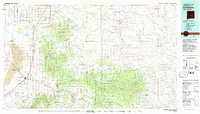
1981 Map of Carrizozo
USGS Topo · Published 1981About this map
The town of Carrizozo, situated at the intersection of major highway routes and the Southern Pacific rail line, serves as the anchor for this desert and mountain landscape. To the west, the volcanic geology of The Malpais is preserved within Valley of Fires State Park, while the eastern horizon is dominated by the peaks of the Jicarilla Mountains and Capitan Mountains. This 1981 survey documents a region defined by its high-altitude topography and extractive history, featuring remote settlements like White Oaks and Jicarilla.
Find a feature on this map
149 named features on this map. Tap any name to fly to it.
Don’t see what you’re looking for? This feature index may not catch every label — zoom into the map to look around manually.
Map Details
Editions of this 1981 Carrizozo Map
2 editions found
Other maps of this area

1916 · Tularosa
USGS Topo · 1:125,000

1918 · Oscura Peak
USGS Topo · 1:125,000

1934 · Capitan
USGS Topo · 1:48,000

1935 · Capitan Mountains
USGS Topo · 1:48,000

1936 · Arabela
USGS Topo · 1:48,000

1937 · Capitan
USGS Topo · 1:62,500

1938 · Carrizozo
USGS Topo · 1:48,000

1940 · Capitan Mountains
USGS Topo · 1:62,500

1942 · Arabela
USGS Topo · 1:62,500

1943 · Carrizozo
USGS Topo · 1:62,500