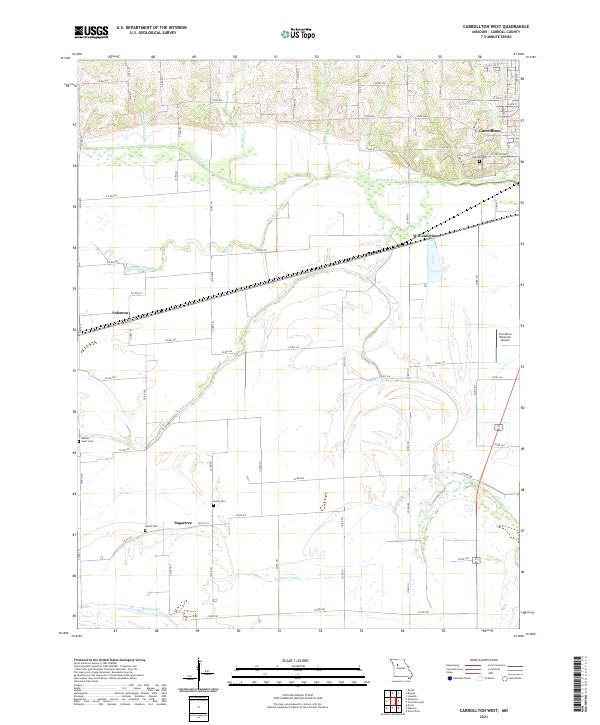
2021 Map of Carrollton West
USGS Topo · Published 2021About this map
Carrollton anchor's the northeastern corner of this Carroll County landscape, where the street grid of the town gives way to the complex hydrology of the Missouri River bottomlands. The terrain is defined by the wandering paths of Wakenda Creek and the low-lying wetlands of Booker Slough and Dirt Slough. These drainage patterns dictated the placement of early infrastructure, seen in the linear route through Palemon and the rail alignment at W B Junction.
Find a feature on this map
73 named features on this map. Tap any name to fly to it.
Don’t see what you’re looking for? This feature index may not catch every label — zoom into the map to look around manually.
Map Details
Editions of this 2021 Carrollton West Map
This is the sole edition of this map. No revisions or reprints were ever made.
Other maps of this area

1889 · Lexington
USGS Topo · 1:125,000

1890 · Marshall
USGS Topo · 1:125,000

1892 · Marshall
USGS Topo · 1:125,000

1901 · Marshall
USGS Topo · 1:125,000

1950 · Dover
USGS Topo · 1:24,000
1951 · Dover
USGS Topo · 1:24,000

1951 · Carrollton East
USGS Topo · 1:24,000
1951 · Standish
USGS Topo · 1:24,000

1951 · Waverly
USGS Topo · 1:24,000

1953 · Moberly
USGS Topo · 1:250,000