
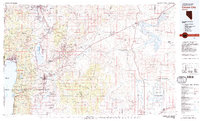
1979 Map of Carson City
USGS Topo · Published 1980About this map
The Comstock Lode heritage is prominent in this late 1970s survey, marking the historic mining corridor through Virginia City, Gold Hill, and Silver City. The landscape transitions from the developed edge of Reno and Carson City to the high desert terrain of the Virginia Range and Pine Nut Mountains. Institutional and educational history is anchored by the Stewart Indian School and several state corrections facilities, including the Nevada State Maximum Security Prison. To the west, the eastern shores of Lake Tahoe are detailed, showing Incline Village and Glenbrook alongside the Toiyabe National Forest. The map also captures the agricultural and water infrastructure of the Carson River basin, reaching eastward to the Lahontan Reservoir and the Fort Churchill Historic State Monument, reflecting a region balancing urban growth with its industrial and frontier past.
Find a feature on this map
131 named features on this map. Tap any name to fly to it.
Don’t see what you’re looking for? This feature index may not catch every label — zoom into the map to look around manually.
Map Details
Editions of this 1979 Carson City Map
2 editions found
Other maps of this area

1889 · Pyramid Peak
USGS Topo · 1:125,000

1889 · Markleeville
USGS Topo · 1:125,000

1890 · Wadsworth
USGS Topo · 1:125,000

1890 · Sierraville
USGS Topo · 1:125,000

1891 · Carson
USGS Topo · 1:125,000

1891 · Markleeville
USGS Topo · 1:125,000

1891 · Truckee
USGS Topo · 1:125,000

1891 · Wabuska
USGS Topo · 1:125,000

1891 · Reno
USGS Topo · 1:125,000

1891 · Pyramid Peak
USGS Topo · 1:125,000