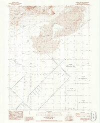
1986 Map of Carson Sink SW
USGS Topo · Published 1986About this map
The arid basin of the Carson Sink (Depression) dominates this mid-1980s survey, illustrating a landscape defined by water management and natural alkaline formations. Much of the quadrangle is occupied by the Stillwater Wildlife Management Area and the Fallon Nat Wildlife Ref, reflecting the region's importance as a wetland habitat within the desert. To the west, the West Humboldt Range and Mopung Hills rise above the basin floor, while the lowlands are characterized by Alkali Flats and shifting Sand Dunes. Human intervention is visible through the Salt Evaporator and the extensive network of Spoil Banks and dikes that channel the Humboldt Slough, showing how the land was engineered for industrial and conservation purposes during this era.
Find a feature on this map
15 named features on this map. Tap any name to fly to it.
Don’t see what you’re looking for? This feature index may not catch every label — zoom into the map to look around manually.
Map Details
Editions of this 1986 Carson Sink SW Map
This is the sole edition of this map. No revisions or reprints were ever made.
Other maps of this area

1908 · Carson Sink
USGS Topo · 1:250,000

1910 · Carson Sink
USGS Topo · 1:250,000

1950 · Stillwater
USGS Topo · 1:62,500

1951 · Soda Lake
USGS Topo · 1:62,500

1951 · Carson Sink
USGS Topo · 1:62,500

1951 · Desert Peak
USGS Topo · 1:62,500

1957 · Reno
USGS Topo · 1:250,000

1959 · Reno
USGS Topo · 1:250,000

1960 · Reno
USGS Topo · 1:250,000

1979 · Carson Sink
USGS Topo · 1:100,000