
1979 Map of Carson Sink
USGS Topo · Published 1979About this map
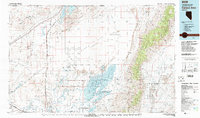
The Carson Sink defines this high-desert basin, where the Humboldt River and Carson River terminate in a vast expanse of alkali flats and sand dunes. By the late 1970s, the landscape was a complex mosaic of conservation and military use, featuring the Fallon National Wildlife Refuge and a large US Navy Bombing Target Area centered on Lone Rock. To the west, the Southern Pacific railroad skirts the Hot Springs Mountains, connecting remote sidings like Huxley and Parran. Cultural history is anchored by the Lovelock Indian Caves and Ocala Indian Cave, while the mineral-rich slopes of the Trinity Range and Stillwater Range are dotted with legacy operations such as the Copper Queen Mine and Silver Ridge Mine. The town of Stillwater serves as the primary outpost near the intricate wetlands of the Stillwater Wildlife Management Area.
Find a feature on this map
106 named features on this map. Tap any name to fly to it.
Don’t see what you’re looking for? This feature index may not catch every label — zoom into the map to look around manually.
Map Details
Editions of this 1979 Carson Sink Map
2 editions found
Other maps of this area

1886 · Granite Range
USGS Topo · 1:250,000

1890 · Wadsworth
USGS Topo · 1:125,000

1891 · Wabuska
USGS Topo · 1:125,000

1892 · Wadsworth
USGS Topo · 1:125,000

1894 · Granite Range
USGS Topo · 1:250,000

1894 · Wadsworth
USGS Topo · 1:125,000

1894 · Wabuska
USGS Topo · 1:125,000

1908 · Carson Sink
USGS Topo · 1:250,000

1910 · Carson Sink
USGS Topo · 1:250,000

1931 · Lovelock
USGS Topo · 1:250,000