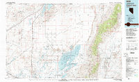
1979 Map of Carson Sink
USGS Topo · Published 1979About this map
The Carson Sink dominates this interior Nevada landscape, a vast desert basin where the Humboldt River and Carson River terminate. In the late 1970s, the region was a complex patchwork of conservation, military use, and resource extraction. The Stillwater National Wildlife Refuge and Fallon National Wildlife Refuge preserve critical wetlands like Big Water and Foxtail Lake, providing a stark contrast to the nearby US Navy Bombing Target Area.
Find a feature on this map
75 named features on this map. Tap any name to fly to it.
Don’t see what you’re looking for? This feature index may not catch every label — zoom into the map to look around manually.
Map Details
Editions of this 1979 Carson Sink Map
2 editions found

Other maps of this area

1886 · Granite Range
USGS Topo · 1:250,000

1890 · Wadsworth
USGS Topo · 1:125,000

1891 · Wabuska
USGS Topo · 1:125,000

1892 · Wadsworth
USGS Topo · 1:125,000

1894 · Granite Range
USGS Topo · 1:250,000

1894 · Wadsworth
USGS Topo · 1:125,000

1894 · Wabuska
USGS Topo · 1:125,000

1908 · Carson Sink
USGS Topo · 1:250,000

1910 · Carson Sink
USGS Topo · 1:250,000

1931 · Lovelock
USGS Topo · 1:250,000