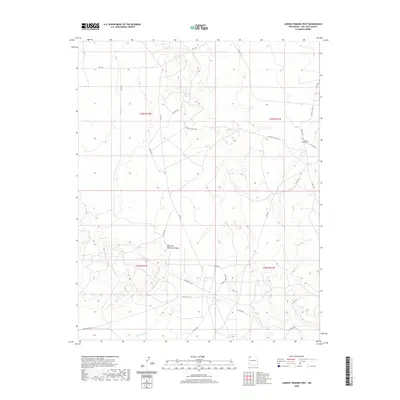
2020 Map of Carson Trading Post
USGS Topo · Published 2020About this map
Carson Trading Post serves as a primary landmark in this corner of San Juan County, situated near the intersection of several local routes in a landscape defined by seasonal drainages. The area is dominated by the intricate network of the West Fork Gallegos Canyon and the Hunter Wash, which carve through the high desert terrain. This 2020 survey illustrates the modern road infrastructure necessary for navigating the vast spaces of the Eastern Navajo Agency, featuring routes like Indian Svc Rte 5 and Indian Svc Rte 7024. The map provides a clear view of the Public Land Survey System grid, including townships t26n r12w and t26n r11w, reflecting the structured management of this arid region. The proximity of the trading post to the canyon systems highlights the historical and contemporary importance of these central hubs for the local community.
Find a feature on this map
25 named features on this map. Tap any name to fly to it.
Don’t see what you’re looking for? This feature index may not catch every label — zoom into the map to look around manually.
Map Details
Editions of this 2020 Carson Trading Post Map
This is the sole edition of this map. No revisions or reprints were ever made.
Other maps of this area

1889 · Largo
USGS Topo · 1:250,000

1889 · Chaco
USGS Topo · 1:250,000

1892 · Chaco
USGS Topo · 1:250,000

1895 · Largo
USGS Topo · 1:250,000

1954 · Shiprock
USGS Topo · 1:250,000

1954 · Aztec
USGS Topo · 1:250,000

1958 · Shiprock
USGS Topo · 1:250,000

1958 · Aztec
USGS Topo · 1:250,000

1959 · Shiprock
USGS Topo · 1:250,000

1960 · Bloomfield
USGS Topo · 1:62,500