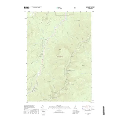
2018 Map of Carter Dome
USGS Topo · Published 2018About this map
White Mountain National Forest dominates this high-altitude landscape, centered on the formidable ridge of the Carter Range. The terrain is defined by a succession of major peaks, including Mt Moriah, North Carter Mtn, South Carter Mtn, and the titular Carter Dome, which rises above the deep depression of Carter Notch. Along the western edge, the Peabody River valley provides a corridor for the Mt Washington Auto Road and the Glen House settlement, serving as a primary gateway for mountaineers and visitors to the Mount Washington Valley.
Find a feature on this map
60 named features on this map. Tap any name to fly to it.
Don’t see what you’re looking for? This feature index may not catch every label — zoom into the map to look around manually.
Map Details
Editions of this 2018 Carter Dome Map
This is the sole edition of this map. No revisions or reprints were ever made.
Other maps of this area

1893 · Mt. Washington
USGS Topo · 1:62,500

1893 · Gorham
USGS Topo · 1:62,500

1894 · North Conway
USGS Topo · 1:62,500

1895 · Crawford Notch
USGS Topo · 1:62,500

1896 · Mt. Washington
USGS Topo · 1:62,500

1896 · Crawford Notch
USGS Topo · 1:62,500

1896 · North Conway
USGS Topo · 1:62,500

1896 · Gorham
USGS Topo · 1:62,500

1935 · Mt. Washington
USGS Topo · 1:62,500

1937 · Gorham
USGS Topo · 1:48,000