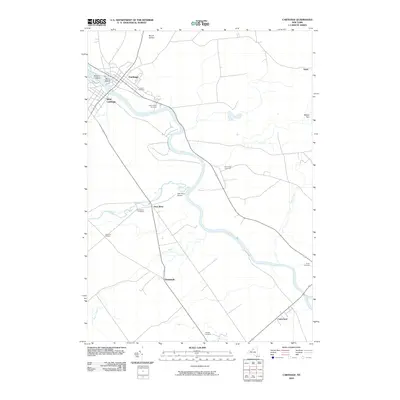
2010 Map of Carthage
USGS Topo · Published 2010About this map
Black River defines the geography of this northern New York region, winding past the twin settlements of Carthage and West Carthage. In the river's path, landforms like Tannery Island and Wind Island mark historical points of river-based activity. The surrounding landscape is dotted with smaller hamlets and crossroads such as Deer River, Denmark, and Castorland, where the Beaver River and Deer River watercourses intersect with the larger drainage basin.
Find a feature on this map
23 named features on this map. Tap any name to fly to it.
Don’t see what you’re looking for? This feature index may not catch every label — zoom into the map to look around manually.
Map Details
Editions of this 2010 Carthage Map
This is the sole edition of this map. No revisions or reprints were ever made.
Other maps of this area

1902 · Carthage
USGS Topo · 1:62,500

1904 · Carthage
USGS Topo · 1:62,500

1911 · Antwerp
USGS Topo · 1:62,500

1911 · Lowville
USGS Topo · 1:62,500

1913 · Lowville
USGS Topo · 1:62,500

1913 · Lake Bonaparte
USGS Topo · 1:62,500

1916 · Lake Bonaparte
USGS Topo · 1:62,500

1942 · Copenhagen
USGS Topo · 1:24,000

1943 · Copenhagen
USGS Topo · 1:31,680
1943 · New Boston
USGS Topo · 1:31,680