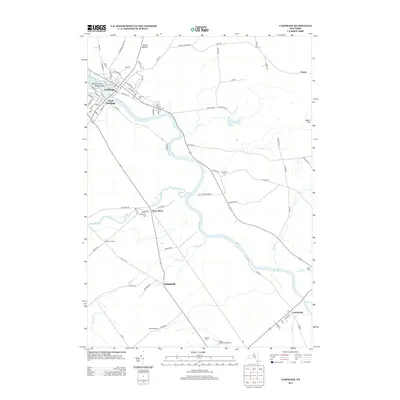
2013 Map of Carthage
USGS Topo · Published 2013About this map
The Black River defines the industrial and geographic heart of this Jefferson County region, flowing between the twin settlements of Carthage and West Carthage. In these riverside communities, a dense grid of streets like S Main St and S Clinton St reflects a long history of water-powered development, punctuated by islands such as Tannery Island and Wind Island. Further south along the river's winding path, the smaller hamlets of Deer River, Denmark, and Castorland appear alongside their historic burial grounds, including Swinburne Cem and Union Cem. The landscape transitions from the developed riverfront to higher elevations at Mount Quillen and Mount Tom, while agricultural and recreation sites like Happy Hollow Campground sit tucked along the tributaries of Stony Cr and Swiss Cr.
Find a feature on this map
86 named features on this map. Tap any name to fly to it.
Don’t see what you’re looking for? This feature index may not catch every label — zoom into the map to look around manually.
Map Details
Editions of this 2013 Carthage Map
This is the sole edition of this map. No revisions or reprints were ever made.
Other maps of this area

1902 · Carthage
USGS Topo · 1:62,500

1904 · Carthage
USGS Topo · 1:62,500

1911 · Antwerp
USGS Topo · 1:62,500

1911 · Lowville
USGS Topo · 1:62,500

1913 · Lowville
USGS Topo · 1:62,500

1913 · Lake Bonaparte
USGS Topo · 1:62,500

1916 · Lake Bonaparte
USGS Topo · 1:62,500

1942 · Copenhagen
USGS Topo · 1:24,000

1943 · Copenhagen
USGS Topo · 1:31,680
1943 · New Boston
USGS Topo · 1:31,680