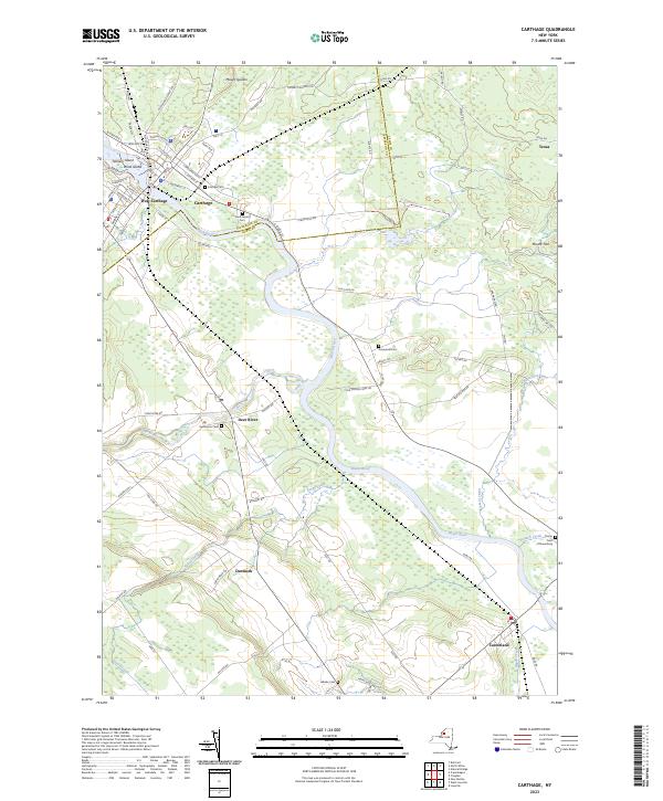
2023 Map of Carthage
USGS Topo · Published 2023About this map
Black River meanders through the heart of this landscape, anchoring the neighboring settlements of Carthage and West Carthage. The river's influence is evident in the presence of Tannery Island and Wind Island, which sit just off the village centers, hinting at a long history of water-powered industry and island-based activity. To the south and east, the terrain transitions into a more rural character defined by agricultural reaches and small hamlets including Denmark, Deer River, and Castorland.
Find a feature on this map
78 named features on this map. Tap any name to fly to it.
Don’t see what you’re looking for? This feature index may not catch every label — zoom into the map to look around manually.
Map Details
Editions of this 2023 Carthage Map
This is the sole edition of this map. No revisions or reprints were ever made.
Other maps of this area

1902 · Carthage
USGS Topo · 1:62,500

1904 · Carthage
USGS Topo · 1:62,500

1911 · Antwerp
USGS Topo · 1:62,500

1911 · Lowville
USGS Topo · 1:62,500

1913 · Lowville
USGS Topo · 1:62,500

1913 · Lake Bonaparte
USGS Topo · 1:62,500

1916 · Lake Bonaparte
USGS Topo · 1:62,500

1942 · Copenhagen
USGS Topo · 1:24,000

1943 · Copenhagen
USGS Topo · 1:31,680
1943 · New Boston
USGS Topo · 1:31,680