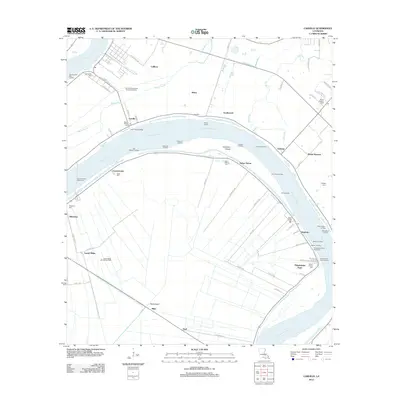
2012 Map of Carville
USGS Topo · Published 2012About this map
The winding Mississippi River defines the landscape of this river-centered parish, where a dense network of landings reflects a long history of waterborne commerce and travel. Prominent landings such as One Hundred Mile Landing, Hard Times Landing, and Elsie Landing line the banks, serving small settlements like Carville and Geismar. The river's influence is seen in the Philadelphia Point Revetment and the operation of the Carville-White Castle Ferry, providing critical passage across the wide channel.
Find a feature on this map
80 named features on this map. Tap any name to fly to it.
Don’t see what you’re looking for? This feature index may not catch every label — zoom into the map to look around manually.
Map Details
Editions of this 2012 Carville Map
This is the sole edition of this map. No revisions or reprints were ever made.
Other maps of this area

1892 · Donaldsonville
USGS Topo · 1:62,500

1908 · Baton Rouge
USGS Topo · 1:62,500

1934 · Denham Springs
USGS Topo · 1:62,500

1935 · Gonzales
USGS Topo · 1:31,680

1936 · White Castle
USGS Topo · 1:62,500

1939 · Denham Springs
USGS Topo · 1:62,500

1939 · Baton Rouge
USGS Topo · 1:62,500

1939 · Donaldsonville
USGS Topo · 1:62,500

1947 · Donaldsonville
USGS Topo · 1:31,680

1953 · Plaquemine
USGS Topo · 1:24,000