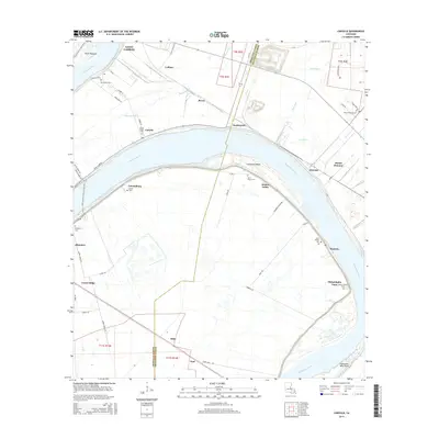
2015 Map of Carville
USGS Topo · Published 2015About this map
The Mississippi River defines the landscape of this river-bend region as it winds between Iberville and Ascension Parishes. This survey captures the traditional riverfront settlements that grew along the fertile banks and natural levees, including Geismar, Hohen Solms, and Carville. The infrastructure of the era is evident in the White Castle-Carville Ferry Xing, which once provided a vital connection across the waterway before the expansion of modern bridge networks. Numerous cemeteries are found along the river roads, such as Jerusalem Cem, Saint Marys Cem, and Saint Phillip Cem, serving as key markers for genealogical research. The interior land shows a transition from the river-oriented communities of Modeste and Alhambra to the drainage networks of Bayou Braud and the New River.
Find a feature on this map
62 named features on this map. Tap any name to fly to it.
Don’t see what you’re looking for? This feature index may not catch every label — zoom into the map to look around manually.
Map Details
Editions of this 2015 Carville Map
This is the sole edition of this map. No revisions or reprints were ever made.
Other maps of this area

1892 · Donaldsonville
USGS Topo · 1:62,500

1908 · Baton Rouge
USGS Topo · 1:62,500

1934 · Denham Springs
USGS Topo · 1:62,500

1935 · Gonzales
USGS Topo · 1:31,680

1936 · White Castle
USGS Topo · 1:62,500

1939 · Denham Springs
USGS Topo · 1:62,500

1939 · Baton Rouge
USGS Topo · 1:62,500

1939 · Donaldsonville
USGS Topo · 1:62,500

1947 · Donaldsonville
USGS Topo · 1:31,680

1953 · Plaquemine
USGS Topo · 1:24,000