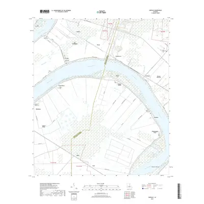
2018 Map of Carville
USGS Topo · Published 2018About this map
The Mississippi River carves a sweeping path through the heart of the River Parishes, defining the boundary between Iberville and Ascension Parishes. This late 2010s landscape is characterized by a series of riverside settlements and points, including Carville, Southwood, and Modeste, many of which developed along the winding River Road. The proximity to the river is evident in the numerous family and church-affiliated burial grounds that dot the riverbanks, such as Mount Bethel Baptist Cem and Saint Marys Cem.
Find a feature on this map
65 named features on this map. Tap any name to fly to it.
Don’t see what you’re looking for? This feature index may not catch every label — zoom into the map to look around manually.
Map Details
Editions of this 2018 Carville Map
This is the sole edition of this map. No revisions or reprints were ever made.
Other maps of this area

1892 · Donaldsonville
USGS Topo · 1:62,500

1908 · Baton Rouge
USGS Topo · 1:62,500

1934 · Denham Springs
USGS Topo · 1:62,500

1935 · Gonzales
USGS Topo · 1:31,680

1936 · White Castle
USGS Topo · 1:62,500

1939 · Denham Springs
USGS Topo · 1:62,500

1939 · Baton Rouge
USGS Topo · 1:62,500

1939 · Donaldsonville
USGS Topo · 1:62,500

1947 · Donaldsonville
USGS Topo · 1:31,680

1953 · Plaquemine
USGS Topo · 1:24,000