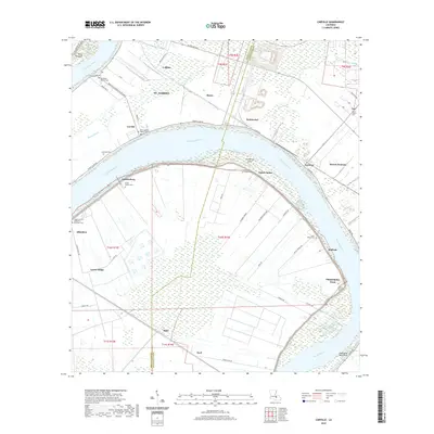
2020 Map of Carville
USGS Topo · Published 2020About this map
The Mississippi River carves a massive, looping bend through this landscape, defining the border between Iberville Parish and Ascension Parish. Along the river's fertile banks, numerous settlements and landing sites like Carville, Hohen Solms, and Modeste are linked by the historic River Rd. This 2020 survey reveals a community deeply anchored by its spiritual and ancestral sites, featuring an extensive network of cemeteries such as the Asbery African Methodist Episcopal Cem and Mount Bethel Baptist Cem. The interior terrain is characterized by a mix of drainage features like Bayou Braud and industrial or agricultural access roads, including Geigy Access Rd and Mulberry Grove Rd. To the south, the river passes Eightyone Mile Point, while islands like Claiborne Island shift within the channel, illustrating the dynamic nature of the lower Mississippi corridor.
Find a feature on this map
64 named features on this map. Tap any name to fly to it.
Don’t see what you’re looking for? This feature index may not catch every label — zoom into the map to look around manually.
Map Details
Editions of this 2020 Carville Map
This is the sole edition of this map. No revisions or reprints were ever made.
Other maps of this area

1892 · Donaldsonville
USGS Topo · 1:62,500

1908 · Baton Rouge
USGS Topo · 1:62,500

1934 · Denham Springs
USGS Topo · 1:62,500

1935 · Gonzales
USGS Topo · 1:31,680

1936 · White Castle
USGS Topo · 1:62,500

1939 · Denham Springs
USGS Topo · 1:62,500

1939 · Baton Rouge
USGS Topo · 1:62,500

1939 · Donaldsonville
USGS Topo · 1:62,500

1947 · Donaldsonville
USGS Topo · 1:31,680

1953 · Plaquemine
USGS Topo · 1:24,000