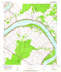
1953 Map of Carville
USGS Topo · Published 1963About this map
The Mississippi River defines the landscape of this riverbend region, where the sweeping curves of the water create natural landforms like Claiborne Island and Philadelphia Point. The map illustrates the specialized land-use patterns of the Louisiana river parishes in the early 1950s, characterized by long, narrow property lines extending back from the riverbanks. Notable institutional landmarks are present, most notably the National Leprosarium south of Carville.
Find a feature on this map
51 named features on this map. Tap any name to fly to it.
Don’t see what you’re looking for? This feature index may not catch every label — zoom into the map to look around manually.
Map Details
Editions of this 1953 Carville Map
This is the sole edition of this map. No revisions or reprints were ever made.
Other maps of this area

1892 · Donaldsonville
USGS Topo · 1:62,500

1908 · Baton Rouge
USGS Topo · 1:62,500

1934 · Denham Springs
USGS Topo · 1:62,500

1935 · Gonzales
USGS Topo · 1:31,680

1936 · White Castle
USGS Topo · 1:62,500

1939 · Denham Springs
USGS Topo · 1:62,500

1939 · Baton Rouge
USGS Topo · 1:62,500

1939 · Donaldsonville
USGS Topo · 1:62,500

1947 · Donaldsonville
USGS Topo · 1:31,680

1953 · Plaquemine
USGS Topo · 1:24,000