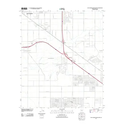
2011 Map of Casa Grande Mountains
USGS Topo · Published 2011About this map
The Casa Grande Mountains rise above the desert floor south of Casa Grande, anchoring a landscape that was rapidly transitioning from agricultural and ranching roots to residential expansion in the early 21st century. This 2011 survey shows the established core of Arizola and the planned street grids of Arizona City to the south, connected by a network of thoroughfares like W Selma Hwy and W Houser Rd. The presence of Mountain View Cemetery near the Treckell Road Interchange serves as a local landmark for researchers of family history in Pinal County. While the northern portion reflects the urban growth of the city, the eastern edge remains dominated by the natural features of Toltec Buttes, illustrating the balance between desert wilderness and the encroaching development characteristic of the modern American Southwest.
Find a feature on this map
90 named features on this map. Tap any name to fly to it.
Don’t see what you’re looking for? This feature index may not catch every label — zoom into the map to look around manually.
Map Details
Editions of this 2011 Casa Grande Mountains Map
This is the sole edition of this map. No revisions or reprints were ever made.
Other maps of this area

1922 · Casa Grande
USGS Topo · 1:62,500

1922 · Signal Peak
USGS Topo · 1:62,500

1924 · Signal Peak
USGS Topo · 1:62,500

1924 · Casa Grande
USGS Topo · 1:62,500

1942 · Silver Reef Mountains
USGS Topo · 1:62,500

1947 · Eloy
USGS Topo · 1:62,500

1948 · Eloy
USGS Topo · 1:62,500

1956 · Tucson
USGS Topo · 1:250,000

1958 · Tucson
USGS Topo · 1:250,000

1959 · Tucson
USGS Topo · 1:250,000