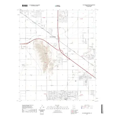
2021 Map of Casa Grande Mountains
USGS Topo · Published 2021About this map
Casa Grande Mountains rise sharply above the desert floor, serving as a prominent landmark between several growing modern communities. This 2021 survey details the suburban expansion at the edges of Casa Grande and Eloy, where residential street grids such as those in Arizona City increasingly border the arid landscape of the Santa Cruz Flats. The presence of the Casa Grande Canal in the northern portion of the map highlights the critical role of water infrastructure in sustaining this high-desert region. Local history and genealogy interests are represented by Mountain View Cem and the settlement of Arizola. The map also captures a complex network of regional thoroughfares, including the well-traveled Jimmie Kerr Blvd, which connects these desert municipalities and facilitates the ongoing development seen across the quadrangle.
Find a feature on this map
107 named features on this map. Tap any name to fly to it.
Don’t see what you’re looking for? This feature index may not catch every label — zoom into the map to look around manually.
Map Details
Editions of this 2021 Casa Grande Mountains Map
This is the sole edition of this map. No revisions or reprints were ever made.
Other maps of this area

1922 · Casa Grande
USGS Topo · 1:62,500

1922 · Signal Peak
USGS Topo · 1:62,500

1924 · Signal Peak
USGS Topo · 1:62,500

1924 · Casa Grande
USGS Topo · 1:62,500

1942 · Silver Reef Mountains
USGS Topo · 1:62,500

1947 · Eloy
USGS Topo · 1:62,500

1948 · Eloy
USGS Topo · 1:62,500

1956 · Tucson
USGS Topo · 1:250,000

1958 · Tucson
USGS Topo · 1:250,000

1959 · Tucson
USGS Topo · 1:250,000